
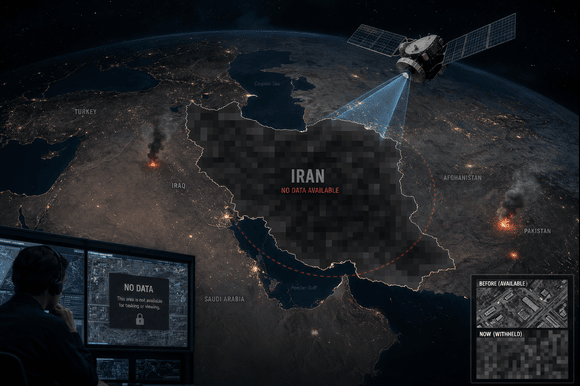
Satellite imaging firm Planet Labs has announced that it will indefinitely restrict the release of imagery covering Iran and the wider Middle East conflict zone, following a request from the administration of Donald Trump.
The US-based company informed its customers of the decision via email on Saturday, stating that the government had asked satellite imagery providers to enforce an “indefinite withhold of imagery” related to the region. The move significantly expands on earlier measures introduced by Planet Labs, which had already implemented a 14-day delay on Middle East imagery last month—an extension of an initial 96-hour restriction. At the time, the company said the delays were intended to prevent hostile actors from exploiting near real-time images to plan or carry out attacks against the United States and its allies.
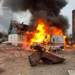
According to the company, the new policy will apply retroactively to imagery captured since March 9 and is expected to remain in place for the duration of the ongoing war. The conflict began on February 28, when the United States and Israel launched coordinated aerial strikes against Iran. Since then, hostilities have escalated across the region, with Iran responding through missile and drone attacks targeting Israeli and US-linked assets, as well as critical civilian infrastructure throughout the Gulf.
Founded in 2010 by former scientists from NASA, Planet Labs said it would transition to a system of “managed distribution” of satellite imagery. Under this approach, only selected images that are assessed as not posing a security risk will be made available to clients.
The company added that any future release of imagery will be handled on a case-by-case basis, particularly for urgent, mission-critical needs or where there is a clear public interest. “These are extraordinary circumstances, and we are doing all we can to balance the needs of all our stakeholders,” the California-based firm said in its communication.
Satellite imagery plays a crucial role in modern military operations, including target identification, weapons guidance, missile tracking, and secure communications. Analysts have suggested that Iran may have access to commercially available satellite data, potentially through third-party providers or allied networks, raising concerns among US officials.
At the same time, such imagery is widely used by journalists, researchers, and academic institutions to monitor developments in inaccessible or conflict-affected areas. The decision to restrict access, therefore, is likely to have broader implications beyond the military domain, potentially limiting independent verification and analysis of events unfolding on the ground.